
Professional Land Surveying Services in Abu Dhabi for Construction Projects
Accurate survey information gives construction and development teams a dependable starting point. Sabah Al Mustaqbal General Contracting LLC provides professional Land Surveying Services Abu Dhabi for residential, commercial, industrial, and infrastructure projects. With 9+ years of experience, we support clients with accurate measurements, mapping, coordinates, and technical reports.
Our services include Topographic Survey Abu Dhabi, Engineering Survey, Boundary Survey, Construction Survey, GPS Survey, GIS Survey, As-Built Survey, Route Survey, and Utility Survey. We select suitable equipment and methods according to the site, project purpose, and required deliverables.
Explore Our Surveying Services
Our surveying services provide useful site information for planning, design, construction, and development work.
Topographic Survey
Construction Survey
GIS Mapping
Route Survey
Boundary Survey
GPS Survey
As-Built Survey
Utility Survey
Follow A Clear Survey Methodology
Project understanding and planning
Field data collection
Control point checks
Data processing and quality checks
Preparation of maps and drawings
Delivery of final survey data
Use Modern Survey Technologies
Survey Equipment And Software
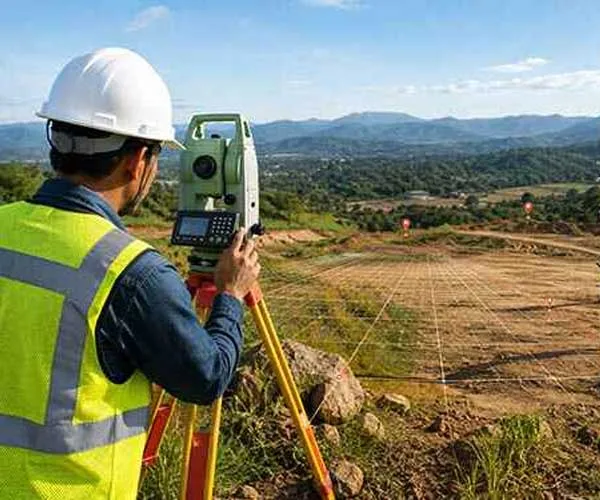
Depending on the project, we can use Total Station, GNSS / GPS, Digital Level, UAV / Drone, GIS Software and CAD Software.
GNSS equipment can collect coordinates, while Total Stations support precise angle and distance measurements. Processed information can then be used for mapping, drawings, and engineering documentation.
Prepare Practical Survey Deliverables
CAD Drawings And Reports
We provide detailed and easy-to-use outputs according to the agreed project scope. Typical Survey Deliverables can include:
CAD Drawings
Site Plans
BIM Models
Contour Maps
Coordinate Data
Survey Control Information
As-Built Drawings
GIS-Compatible Data
Technical Reports
Support Diverse Project Industries
Our Engineering Survey and mapping services can support:
Residential Developments
Commercial Buildings
Industrial Facilities
Infrastructure Projects
Roads & Highways
Utility Projects
Land Development
Construction Sites
Maintain Accuracy And Compliance
Quality Control Procedures
Reliable surveying requires proper field checks, suitable equipment, and careful data review. Our approach includes QA Procedures, measurement checks, and data validation before final information is issued.
Regulatory Compliance
Survey projects may need to follow Abu Dhabi requirements and relevant authority procedures. Where submissions are required, documentation can be prepared to support the applicable process. Specific approvals remain subject to the relevant authority and project scope.
Our quality focus includes:
Accurate measurements and data validation
Compliance with Abu Dhabi regulations
Use of certified equipment
Quality control and review process
Support for authority submissions
Choose Experienced Surveying Support
With 9+ years of experience, Sabah Al Mustaqbal General Contracting LLC provides practical surveying support for construction and engineering projects.
Licensed Survey Team where required
Accurate Survey Data
Modern Equipment
QA Procedures
Local Experience
Technical Reports
Understand Survey Price Ranges
Survey costs depend on site size, accessibility, terrain, survey type, required accuracy, and deliverables. Indicative pricing in Abu Dhabi includes:
Survey Type | Price Range (AED) |
Boundary Survey | 1,500–3,000 |
Topographic Survey | 2,000–4,500 |
Construction Survey | 2,500–5,000 |
Route Survey (per km) | 2,000–6,000 |
Utility Survey | 2,000–5,000 |
As-Built Survey | 2,500–5,000 |
Prices are indicative and may vary according to project complexity and specific requirements. A project-specific quotation provides a more accurate estimate.
Answer Common Survey Questions
What Does Land Surveying Include?
How Long Does A Survey Take?
What Equipment Is Used?
Do You Provide CAD Drawings?
Can Surveys Support Construction?
Do You Handle Authority Approvals?
Survey documentation can support applicable authority submissions, while specific approvals depend on the relevant authority and project requirements.
Plan Your Survey With Us
